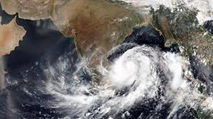
 The India Meteorological Department (IMD) has announced that a new low-pressure area is likely to form in the Bay of Bengal by the day after tomorrow due to the impact of an atmospheric circulation developing over the North Andaman Sea.
IMD Report:
According to the report from the Chennai Meteorological Centre, the intense heat prevailing across Tamil Nadu over the past few days is expected to gradually reduce in the coming days. Due to variations in the westerly winds, moderate rainfall accompanied by thunderstorms and lightning is expected in some parts of Tamil Nadu and Puducherry today. This weather pattern is expected to continue until September 26.
Additionally, the temperature in some areas of Tamil Nadu is expected to rise by up to 4°C today.
In Chennai and its suburban areas, the sky is likely to remain partly cloudy for the next two days. There is also a chance of light to moderate rainfall accompanied by thunderstorms in a few areas.
The maximum daytime temperature is expected to reach 100°F (38°C).
The IMD also reported that an upper-level atmospheric circulation is forming over the Andaman Sea and adjacent regions today. As a result, a new low-pressure area is likely to form over the northwest and central Bay of Bengal by the day after tomorrow.
Due to this development, there is a likelihood of rainfall in the northern districts of Tamil Nadu and surrounding regions in the coming days.
This update comes as relief to residents affected by the recent heatwave, signaling potential rainfall and cooler temperatures in parts of the state.